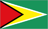
Guyana

Guyana, based on the 1994 national inventory, makes only a minor contribution to emissions of greenhouse gases. However, increases in the global mean temperatures could have significant impact, especially on the coastal plain and on activities including the dominant agriculture sector in Guyana.
Guyana is a tropical country situated on the northeastern coast of South America. It is bounded on the north by the Atlantic Ocean, on the east by Suriname, on the south by Brazil and on the west by Venezuela. It is an English-speaking country with close ties with the English-speaking Caribbean Islands. It is a member of the Caribbean Community (CARICOM) which has its headquarters in Georgetown, the capital city. Guyana has the following characteristics:
- It is a low-lying state with a vulnerable coastal strip 77 km wide in the east and 26 km wide in the western Essequibo region.
- Ninety percent (90 %) of the population resides in the coastal strip where the main urban centres and commercial activities are to be found.
- There is a wide range of geographic types with coastal, hilly sandy, highland, forested and savannah regions.
- There is no current tectonic activity in Guyana and indications are that the Guyana shield (and the coastal strip, in particular) will not be affected by convergence of the South and North American plates.
- There is a high level of rainfall variability in the country and the seasons and climate are determined mainly by this variability. There are two wet and two dry seasons. First Dry Season (February to April); First Wet Season (April to July) Second Dry Season (July to November); and the Second Wet Season (November to January)
The country can be divided into climatic regions ranging from dry (annual rainfall less than 1788 mm) to extremely wet (annual rainfall greater than 4100 mm).
