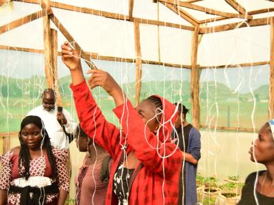
In order to minimize the negative impact of climate change on the ecosystems, water resources, socioeconomic domains, a number of adaptation measures are open to Nigeria. They range from education to inform and encourage behavioural change to changing location and use, preventing effects, modifying threats, and sharing loss.
In Nigeria, in addition to autonomous adaptation, there must also be planned adaptation and adoption of adaptation strategies. These will include, among others: Diversification and extension of protected areas for the conservation of ecosystems that are most vulnerable to climate change and sea level rise; Maintaining ecological structure and processes at all levels and reducing existing pressure on natural ecosystems; Reducing population and ecosystem vulnerability to climate change and reorientation of their evolution towards higher resistance to the changes; Incorporating biodiversity conservation into adaptation strategies in the other sectors of the Nigerian economy; Establishment and maintenance of protected area (in situ preservation), and the active management of wild populations outside of protected areas (ex situ management); Development and implementation of programmes for restricted areas and buffer zones, resource harvesting on a sustainable basis, ecological restoration, sustainable management and agro ecosystems; and Monitoring to evaluate species and ecosystems stability from climate change perspective.
With an estimated population of about 120million (2000), the Federal Republic of Nigeria is the most populous country in Africa. Its 923,800 square kilometres occupies about 14% of West Africa. The country lies between 4oN and 14oN and between 3oE and 15oE. It is bordered on the north, east, and west by Niger, the Cameroon, and Benin Republic, respectively. The Atlantic Ocean forms the southern boundary. The total length of the coastline of the country is about 850 km.
The highest areas are in the east, north, and west, where land is generally over 1,500 metres, 600 metres, and 300 metres respectively. The low-lying areas, which are generally below 300 metres, lie along the coast and along the valleys of the main rivers. (Fig. 1.3). The Udi Plateau, which lies to the east, however attains a height of over 300 meters and this breaks the monotony of the coastal lowlands, which are also characterized by creeks and lagoons on both sides of the Niger Delta. West of the Niger Delta, the coastal areas consist of lagoons and swamps, separated from the open sea, by a strip of sandy land, which varies in width from 2 to 16 kilometres. The Lagos entrance is the only major outlet through which the lagoons and creeks drain into the sea. The section which lies in the east of the Niger Delta consists of creeks and swamps which stretch from Opobo town through the Cross River estuary to the border with the Cameroon.
The Niger Delta is a low-lying region, cut up by a complicated system of natural channels through which the River Niger finds its way to the sea. It is made up of three distinct subregions. They are (a) freshwater zone (b) the mangrove swamps, and (c) the zone of coastal sands and beach ridges. The freshwater zone, which starts from the apex of the delta, just below the town of Aboh, is essentially an extension of the lower Niger floodplains. The numerous water channels in this zone are bordered by natural levees, which provide the sites for most of the settlements and farmlands in the zone. The mangrove swamps, covering about 10,360 square kilometers and located to the south of the freshwater swamps, are sparsely settled. Strips of sandy beaches and ridges, which vary from a few meters to 16 kilometers, separate the mangrove swamps from the open sea. In addition to natural levees, ox-bow lakes are common landforms in the Niger Delta. The high rainfall in the region, coupled with the abundance of surface water and the flat terrain, create a serious drainage problem and makes road construction very difficult.


