Photo:
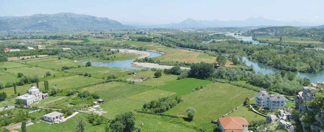
The Drin River Basin (DRB) is a transboundary river basin, which is home to 1.6 million people and extends across, Kosovo*, the Former Yugoslav Republic Macedonia, Montenegro and Greece. Climate change and climate variability have been increasing the frequency, intensity and impact of flooding in the basin. Historical flood data from the Western Balkans suggests a more frequent occurrence of flood events, attributed to an uneven distribution of precipitation and torrential rain, particularly over the last decade. More and larger areas - and more people - are being affected by flooding with a strong impact on national economies. Future climate scenarios project a further increase in the likelihood of floods as well as in their destructive nature. Increased frequency and intensity of floods and droughts, increased water scarcity, intensified erosion and sedimentation, increased intensity of snow melt, sea level rise, and damage to water quality and ecosystems are forecasted. Moreover, climate change impacts on water resources will have cascading effects on human health and many parts of the economy and society, as various sectors directly depend on water such as agriculture, energy and hydropower, navigation, health, tourism – as does the environment.
The objective of the "Integrated climate-resilient transboundary flood risk management in the Drin River basin in the Western Balkans (Albania, the Former Yugoslav Republic of Macedonia, Montenegro)" project is to assist the riparian countries in the implementation of an integrated climate-resilient river basin flood risk management approach in order to improve their existing capacity to manage flood risk at regional, national and local levels and to enhance resilience of vulnerable communities in the DRB to climate-induced floods. The countries will benefit from a basin-wide transboundary flood risk management (FRM) framework based on: improved climate risk knowledge and information; improved transboundary cooperation arrangements and policy framework for FRM and; concrete FRM interventions.
* References to Kosovo shall be understood to be in the context of Security Council Resolution 1244 (1999)
Major achievements to date:
- Optimized hydrometeorological monitoring network design developed for each of the Drin River Basin (DRB) riparians following the relevant network and institutional assessments
- Hydromet monitoring networks strengthened by procurement, installation and/or upgrade of 20 fully automated hydrological and 13 meteorological stations across the basin
- Hi-res Digital Elevation Models (DEMs) and topographic data sets acquired, a basin-wide hydrological model developed to simulate scenarios and calculate hydrographs for studies of the Areas of Potentially Significant Flood Risk (APSFRs)
- Detailed hydraulic model developed for the Crni/Black Drim sub-basin in North Macedonia and targeted APSFRs in Albania, alongside a 1D model of the entire basin
- Methodology and tools developed for vulnerability assessment and prioritization of communities at risk
- A tailored GIS-based flood risk model developed, integrating various spatial socio-economic (s/e) data with the flood hazard maps, performing vulnerability assessment and producing vulnerability maps that include damage and lost assessments. S/e database for the communities at risk established
- Tailor-made trainings on FRM delivered to practitioners, decision-makers and communities
- Appraisal led the design of the (non)structural local flood protection measures undertaken across the prioritized communities
- Structural risk reduction measures constructed/ underway in prioritized areas
- Community resilience strengthened through participatory design and implementation of non-structural measures
- Development of the basin FRM strategy and plan and sectoral FRM policies underway
- Community
- National
- Regional
- Country Office
- National Governments
- United Nations Development Programme (UNDP)
1.6 million people
- Adaptation Fund
- Global Water Partnership
- United Nations Development Programme (UNDP)
Expected outcomes
Component 1: Hazard and Risk Knowledge Management Tools
Component 2: Transboundary institutional, legislative and policy framework for FRM (Flood Risk Management)
Component 3: Community-based climate change adaptation and FRM interventions
- Image

- Image

Climate change impacts
Climate change is already having an impact and is likely to intensify in the future. According to the national communications to UNFCCC from Albania, Montenegro and the Former Yugoslav Republic of Macedonia, as well as to the report ‘The state of water in Kosovo’, climate change will have serious negative impacts in the Drin river basin including increased frequency and intensity of floods and droughts, increased water scarcity, intensified erosion and sedimentation, increased intensity of snow melt, sea level rise, and damage to water quality and ecosystems. Moreover, climate change impacts on water resources will have cascading effects on human health and many parts of the economy and society, as various sectors directly depend on water such as agriculture, energy and hydropower, navigation, health, tourism –as does the environment.
The DRB countries are increasingly exposed to the impact of climate change. They are experiencing increased periods of extreme heat in the summer months and increased rainfall during the cooler seasons. According to long-term projections, the average annual temperature will increase by 2° C to 3° C by 2050 and precipitation will decrease in the summer, resulting in longer dry periods followed by more sudden heavy rainfalls. This combination increases the likelihood of floods as well as their destructive nature.
Historical flood data from the Western Balkans suggests a more frequent occurrence of flood events, characterized by more extreme and more rapid increase in water levels, attributed to an uneven distribution of precipitation and torrential rain, particularly over the last decade. More and larger areas and, therefore, a greater population numbers are being affected by flooding with a strong impact on national economies.
In Albania, climate change projections indicate the intensification of heavy precipitation and an increase in the frequency of heavy rains with longer duration, causing flooding and economic damages. There is already evidence of increasing frequency of high intensity rainfall, which is increasing pluvial or flash flooding which inundates the floodplain in a matter of hours. In winter, longer duration rainfall causes flooding which lasts for several weeks during the winter period while long-duration spring rainfall combines with snowmelt to cause flooding. Flood risk is a combination of river flooding and coastal flooding due to sea water inundation (storm surges), both of which are increasing with climate change.
According to available climate change projections for Montenegro, there will be a sharp increase in variability of river flow, characterized by increased frequency and intensity of flooding and hydrological drought. In addition, coastal flooding and storm surges will also significantly increase. During this period the area of low air pressure develops in the coastal region of Montenegro and has a wide impact causing maximum precipitation in the southern areas. In the karst areas, during spring, there are periodic floods due to longer periods of precipitation, melting snow and high groundwater levels. Such floods have impacted the Cetinje plain several times and have caused severe damage to the buildings there.
The First and Second National Communications on Climate Change for FYR Macedonia outlined a number of scenarios related to water resources. The findings included a projection of a 15% reduction in rainfall by 2050, with a drastic decrease in runoff in all river basins. Although the long-term projection is for increased temperatures and a decrease in sums of precipitation, the past period studied shows significant climate variability with increased precipitation. The proportion of winter precipitation received as rain instead of snow is increasing. Such shifts in the form and timing of precipitation and runoff are of concern to flood risk.
Project details
The AF-financed project will build resilience of communities and livelihoods in the Drin Basin to climate-induced floods by catalyzing a shift to a holistic basin-wide climate-responsive flood risk management and adaptation approaches based on enhanced climate information, risk knowledge, and community structural and non-structural adaptationmeasures.
The proposed integrated approach to climate resilient flood risk management will encompass: a increased technical, human and financial capacities of relevant institutions within each Riparian country, with responsibility for flood risk monitoring, forecasting and management to enable implementation of climate resilient Integrated Flood Risk Management (IFRM). This would include strengthening of the a. hydrometric monitoring network, risk mapping, flood hazard and risk modelling capacity; b.an enhanced policy and risk financing framework for flood risk management based on enhanced understanding of climate risks; c.climate-proof and cost-effective investment into flood protection through enhanced capacities to design and implement structural and non-structural flood risk management measures, and to provide effective flood risk reduction measures to the population; d. enhanced awareness, response and adaptation capacity of the population; engaging private sector into climate information management and risk reduction investment.
The objective of the project is to assist the riparian countries in the implementation of an integrated climate-resilient river basin flood risk management approach in order to improve their existing capacity to manage flood risk at regional, national and local levels and to enhance resilience of vulnerable communities in the DRB to climate-induced floods. The countries will benefit from a basin-wide transboundary flood risk management (FRM) framework based on: improved climate risk knowledge and information; improved transboundary cooperation arrangements and policy framework for FRM and; concrete FRM interventions. 100.As a result, the Adaptation Fund project will improve the resilience of 1.6 million people living in the DRB (direct and indirect beneficiaries). 101.The project will contribute to the strengthening of the current flood forecasting and early warning system by increasing the density of the hydrometric network, and by digitizing historical data for stations not currently in the existing forecasting model. The project will develop and implement transboundary integrated FRM strategies providing the national authorities with robust and innovative solutions for FRM, DRR and climate adaptation, including ecosystem-based gender sensitive participatory approaches. In addition, the project will develop the underlying capacity of national and regional institutions to ensure sustainability and to scale up the results. It will support stakeholders by providing guidance, sharing climate information, knowledge and best practices. The project will also invest in the priority structural and community-based non-structural measures. Importantly, the project is aligned with and will support the implementation of the EU Floods Directive (EUFD) in DRB countries.102.The AF project will build upon experience of Regional UNDP/GEF Drin project (see baseline initiatives section above) and otherprojects25,26in the region and will include the following innovations:1) introduction of international best practice in flood hazard and risk assessment, modelling and mapping in line with EUFD; 2) innovative mix of structural and non-structural interventions based on climate risk-informed design; 3) agro-forestry measures and community-based flood resilience schemes. The socio-economic benefits include reduced damages and losses and improved food production (through protection of agricultural land). This will have direct and indirect livelihood protection and potential income generation benefits. Climate risk informed planning of the hydropower sector is important to enhance hydropower operations to include transboundary climate-induced flood risk management, thus ensuring the continued sustainable development of the hydropower sector which will help continue the shift to clean energy in the region. Climate risk information will also safeguard critical infrastructure assets such as transportation (roads and bridges) which are critical to the economic development and functioning of communities. Environmental benefits include improved ecosystem functions through better spatial planning and non-structural measures such as agro-forestry, which will provide water retention functions, regulation of hydrological flows (buffer runoff, soil infiltration, groundwater recharge, maintenance of base flows), natural hazard mitigation (e.g. flood prevention, peak flow reduction, soil erosion and landslide control), increased riverbed stabilization resulting in decreased erosion, habitat preservation, and reforestation. This project will directly benefit the most vulnerable parts of the population and will have significant gender co-benefits which will be ensured through close collaboration with a gender expert dedicated to ensuring that gender considerations are a key part of any consultation or activity planning process. Flooding and disasters in general, impact women disproportionately and the project will ensure that these differential impacts are taken account in all project interventions.


