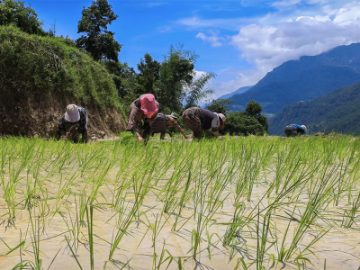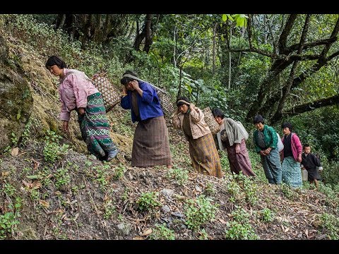
The NAPA II project, Addressing the Risk of Climate-Induced Disasters through Enhanced National and Local Capacity in Bhutan, focused on addressing urgent and immediate climate change adaptation needs and leveraging co-financing resources from national government, bilateral and other multilateral sources, and the private sector. The project sought to “enhance national, local and community capacity to prepare for and respond to climate induced multi-hazards to reduce potential losses of human lives, national economic infrastructure, livelihood and livelihood assets.”
The US$11.49 million project was funded by Global Environment Facility/Least Developed Countries Fund, and coordinated by the National Environment Commission Secretariat in partnership with UNDP, Bhutan. The project will safeguard essential economic and livelihood infrastructure in hazard-prone communities and key industrial areas from increasing climate hazards such as floods, landslides, windstorms and forest fire through reducing vulnerability at high-risk areas and increasing adaptive capacity of community-level disaster risk management institutions.
- Community
- Country Office
- Local Governments
- National Governments
- Non-Governmental Organizations
Rural communities in Bhutan
- Bhutan Department of Hydro-Meteorological Service (DHMS)
- Bhutan Ministry of Agriculture and Forests (MoAF)
- United Nations Development Programme (UNDP)
- Global Environment Facility (GEF)
The overarching objective of the project is to increase national, local and community capacity to prepare for and respond to climate-induced multi-hazards to reduce potential losses of human lives, national economic infrastructure, livelihoods and livelihood assets. This objective is fully aligned with the development priorities of the RGoB as set out in Bhutan’s tenth 5-year plan, which is in turn underpinned and guided by the long-term development vision of Gross National Happiness (GNH) and Bhutan 2020: A Vision for Peace, Prosperity and Happiness. Under the four pillars of GNH (i.e. sustainable and equitable socio-economic development; environmental conservation; preservation and promotion of culture; and good governance), the 5-year plan places a strong emphasis, among others, on balanced rural-urban development for poverty alleviation, expansion/maintenance of key economic infrastructure including road infrastructure that connects rural and urban centers, and strengthening of the agricultural sector which continues to employ the majority of Bhutanese and be the backbone of the rural economy.
This project will implement priority interventions addressed in Bhutan's National Adaptation Programme of Actions corresponding to the following objectives, in part or full, as outlined in NAPA profile:
- Disaster management strategy
- Weather forecasting system to serve farmers and agriculture
- Landslide management and flood prevention
- Flood protection of downstream industrial and agricultural area
- Rainwater harvesting
- Promote community-based forest fire management and prevention
Situated on the southern slope of the Eastern Himalayas, Bhutan’s landscape is mountainous and rugged with elevations ranging from 100m in the southern foothills to 7500m towards north. Due to its topography, habitable and arable areas are limited to approximately 8.3% and 2.9%, respectively, of the landmass. Agriculture, which employs 69% of the population and accounts for 78% of monetary income in rural households, and industrial activities are largely practiced in this highly confined space that its topography permits. While Bhutan is in general endowed with abundant water resources from the four major rivers and their tributaries, most of the large rivers are at the bottom of valleys and gorges rendering these rich water resources largely inaccessible for agriculture or domestic use. As a result, irrigation is limited to areas near small perennial streams that exist above main rivers and majority of farmers rely primarily on monsoonal rains, which account for 60-90% of annual precipitation.
Bhutan is one of the most disaster prone countries in the Asia-Pacific region, irrespective of the presence of climate change. The country is exposed to multiple hazards, most prominently flash floods, landslides, windstorms, earthquakes, forest fires, and glacial lake outburst floods (GLOFs). In terms of relative exposure to flood risks (as % of population), Bhutan ranks fourth highest in the region. Although the direct human risks of landslides, windstorms, and forest fires are not particularly higher compared to other countries, the socioeconomic repercussions from these events are thought to be high due to the baseline poverty prevalence.
Climate change is likely to magnify the intensity and frequency of these hazards. In fact, according to the International Disaster Database, among the top 10 natural disasters in Bhutan between 1900 to 2012, in terms of the number of casualties and number affected, all of them occurred in the last two decades (except epidemic outbreaks), which makes certain degree of attribution of climate change to the increasing magnitude of such hazards plausible. The most pronounced consequences of climate change in Bhutan are two folds: disruptions in the monsoonal system and increasing/intensifying trends of extreme hydro-meteorological hazards, both of which are obviously closely linked. These disturbances will amplify the socioeconomic challenges for the Bhutanese society, especially in rural areas where the majority of the population is engaged in rain-fed agriculture and rampant poverty makes them least equipped to adapt to creeping changes in climate.
Monsoon rains generally arrive during the summer months (from late June to late September). Downscaled simulations undertaken in Bhutan’s SNC indicate that the mean annual rainfall will increase by 26-30% by 2069 compared to the baseline year of 1980. This increase occurs primarily during the summer monsoon season while the dry winter season rainfall is projected to decline slightly. In addition, accelerated melting of glaciers, which act as a gigantic natural water retention and dispensing mechanism to communities downstream, is disrupting the hydrological regime of the perennial river systems in the region. All in all, climate change will increase the uncertainty of water availability throughout the year, and rural farmers are likely to have to better manage high fluctuation of rainfalls – increasing volume of monsoonal rain so that they can sustain longer dry periods. This poses significant risks to development when built rural infrastructure to alleviate water shortages, such as communal rainwater harvesting, is minimally available.
Source: UNDP Bhutan Project Identification Form (May 1, 2012)
- Outcome 1: Risks from climate-induced floods and landslides reduced in the economic and industrial hub of Bhutan
- Output 1.1: Protection of Pasakha Industrial area from flooding events through riverbank protection, river training and development of flood buffer zones
- Output 1.2: Slope stabilization to reduce climate-induced landslides in the Phuntsholing Township
- Output 1.3: Integrated risk hazard assessment and mapping completed in 4 critical landslide and flashflood prone areas with data collection standards compatible with the national database
- Outcome 2: Community resilience to climate-induced risks (drought, flood, landslides, windstorms, forest fires) strengthened in at least four Dzongkhags
- Output 2.1: Climate-resilient water harvesting, storage and distribution systems designed, built and rehabilitated in at least four Dzongkhags, based on observed and projected changes in rainfall patterns and intensity
- Output 2.2: Community-level water resource inventory completed and maintained by Dzongkhag administration to increase the adaptive capacity of communities in the face of increasing water scarcity
- Output 2.3: Disaster Management Institutions at various levels established and trained in four Dzongkhags to prepare for, and respond to, more frequent and intense floods, storms and wildfire events
- Outcome 3: Relevant information about climate-related risks and threats shared across community-based organizations and planners in climate-sensitive policy sectors on a timely and reliable basis
- Output 3.1: Enhanced quality, availability and transfer of real-time climate data in all Dzongkhags which experience increasing frequency of extreme hydo-meterological events
- Output 3.2: Increased effectiveness of National Weather and Flood Forecasting and Warning Center through improved capacity to analyze, manage and disseminate climate information in a timely manner
Source: UNDP Bhutan Project Identification Form (May 1, 2012)
Project Start:
- Project Inception Workshop: will be held within the first 2 months of project start with those with assigned roles in the project organization structure, UNDP country office and where appropriate/feasible regional technical policy and programme advisors as well as other stakeholders. The Inception Workshop is crucial to building ownership for the project results and to plan the first year annual work plan.
Daily:
- Day to day monitoring of implementation progress: will be the responsibility of the Project Manager, based on the project's Annual Work Plan and its indicators, with overall guidance from the Project Director. The Project Team will inform the UNDP-CO of any delays or difficulties faced during implementation so that the appropriate support or corrective measures can be adopted in a timely and remedial fashion.
Quarterly:
- Project Progress Reports (PPR): quarterly reports will be assembled based on the information recorded and monitored in the UNDP Enhanced Results Based Management Platform. Risk analysis will be logged and regularly updated in ATLAS.
Annually:
- Annual Project Review/Project Implementation Reports (APR/PIR): This key report is prepared to monitor progress made since project start and in particular for the previous reporting period (30 June to 1 July). The APR/PIR combines both UNDP and GEF reporting requirements.
Periodic Monitoring through Site Visits:
- UNDP CO and the UNDP RCU will conduct visits to project sites based on the agreed schedule in the project's Inception Report/Annual Work Plan to assess first hand project progress. Other members of the Project Board may also join these visits. A Field Visit Report/BTOR will be prepared by the CO and UNDP RCU and will be circulated no less than one month after the visit to the project team and Project Board members.
Mid-Term of Project Cycle:
- Mid-Term Evaluation: will determine progress being made toward the achievement of outcomes and will identify course correction if needed. It will focus on the effectiveness, efficiency and timeliness of project implementation; will highlight issues requiring decisions and actions; and will present initial lessons learned about project design, implementation and management. Findings of this review will be incorporated as recommendations for enhanced implementation during the final half of the project’s term.
End of Project:
- Final Evaluation: will take place three months prior to the final Project Board meeting and will be undertaken in accordance with UNDP and GEF guidance. The final evaluation will focus on the delivery of the project’s results as initially planned (and as corrected after the mid-term evaluation, if any such correction took place). The final evaluation will look at impact and sustainability of results, including the contribution to capacity development and the achievement of global environmental benefits/goals. The Terminal Evaluation should also provide recommendations for follow-up activities.
- Project Terminal Report: This comprehensive report will summarize the results achieved (objectives, outcomes, outputs), lessons learned, problems met and areas where results may not have been achieved. It will also lie out recommendations for any further steps that may need to be taken to ensure sustainability and replicability of the project’s results.
Learning and Knowledge Sharing:
- Results from the project will be disseminated within and beyond the project intervention zone through existing information sharing networks and forums.
- The project will identify and participate, as relevant and appropriate, in scientific, policy-based and/or any other networks, which may be of benefit to project implementation though lessons learned. The project will identify, analyze, and share lessons learned that might be beneficial in the design and implementation of similar future projects.
- Finally, there will be a two-way flow of information between this project and other projects of a similar focus.
- UNDPUgyen DorjiProject Support Officer
- UNDPMs. Mariana SimoesRegional Technical Advisor, Climate Adaptation
- UNDPYusuke TaishiRegional Technical Advisor


