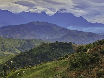
Colombia has a total area of 207’040.800 hectares, of which 114’174.800 are continental land mass and 95’866.000 are territorial waters. The island zones consist of a series of islands in the Pacific (Malpelo and Gorgona) and in the Caribbean (archipelago of San Andres and Providencia, and a large number of keys, islets and shallows). Pacific waters cover 33’930.000 hectares and Caribbean waters 48’936.000 hectares. This makes Colombia the fourth largest country in South America and the only one with Caribbean and Pacific coasts. There are five main natural regions on the mainland: Caribbean, Andean, Pacific, Orinoquia and Amazonia.
The greater part of the country enjoys more or less the same temperature ranges of an annual average of 24-28°C in the eastern zone of the Caribbean plains and a strip of the Pacific coast. Average annual temperatures of over 28°C are to be found in the lower, middle and part of the upper Magdalena valley. In a much smaller area, including Andean and Interandean zones, there is a variety of thermic levels due to the wide variations of air temperature at higher altitudes. The snow line, with temperatures lower than 0°C, is found above 4.600 m above sea level, and is the smallest of the land areas of Colombia.
Like most countries in the region, Colombia has submitted one National Communication to the United Nations Framework Convention on Climate Change (UNFCCC) in December 2001, laying out the actions that the government has already taken and the analytical basis for its policy response to climate change and its commitment to take future actions within an official international framework. The Communication established the First National GHG Inventories for 1990 and 1994, it presented the actions done for mitigation of GHG emissions in Colombia, as well as vulnerability and adaptation studies for the coastal area, water resources, agricultural sector and land management.
Work on the Second National Communication has already started and it is scheduled to be completed by early 2010. It will include an update of the National GHG Inventory for 2000 and 2004, vulnerability and adaptation studies for various sectors, including water resources, and a chapter on mitigation measures. It will also include a National Strategy on education, information and awareness raising about the issue to climate change” and climate change scenarios defined by the IPCC (A2 and B2).
The Integrated National Adaptation Project (INAP) was designed with the purpose of supporting Colombia’s efforts to define and implement prevention and adaptation measures to climate change. It has duration of five years and focuses mainly on highland ecosystems, the island areas and human health. One of the activities of this project is to work with local communities of the Highlands on land-use adaptation projects aimed at reducing the impact and degradation of this resource. Formulation of an Integrated Action Plan for Climate Change is a priority for Colombia and it is in the process of being elaborated.
Source: World Bank Country Notes on Climate Change Aspects in Agriculture. Accessed on: 24 May 2010
The Country Notes are a useful tool for organizing in a systematic way the available information on climate change and agriculture in each country. They provide a brief summary of information pertinent to both climate change and agriculture in 19 countries in LAC, with focus on policy developments (action plans and programs), institutional make-up, specific adaptation and mitigation strategies, as well as social aspects and insurance mechanisms to address risk in the sector.


